Ozzie

Ozzie

Tuesday, 29 July 2014

Day 85: Pingvellir National Park to Hveravellir Geothermal Area - Tues 29 July

Day 85: Pingvellir National Park to Hveravellir Geothermal Area - Tues 29 July
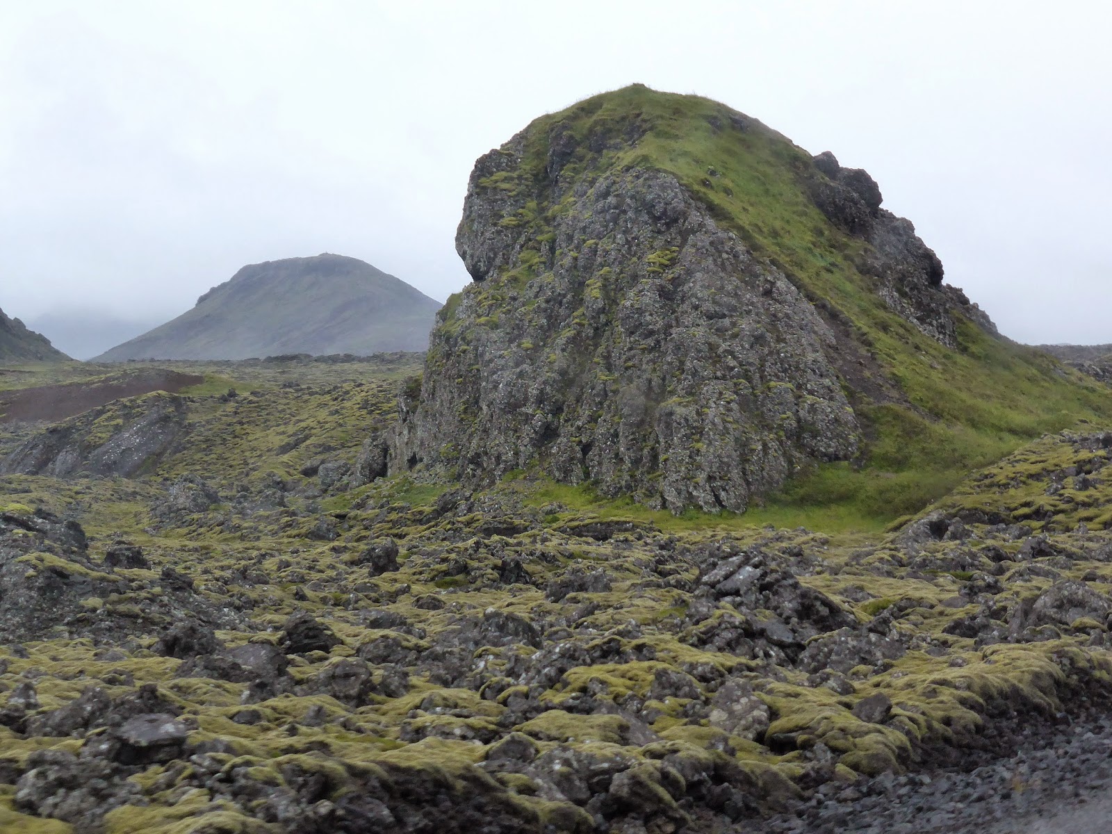
Wind howled wildly down our valley and shook Ozzie all night, and continued this morning - even though sun is shining, we were happy to move on this morning. The remains of Iceland’s Parliament lie in a tectonic rift valley that marks the crest of the Mid-Atlantic Ridge. According to the Book of Settlements the first assembly in 930 aimed to unite the Norse and Celtic settlers. Pingvellir became the centre of Icelandic culture; thousands of people flocked annually. They set up dwellings with walls of turf, rock and temporary roofing, staying for the two weeks of the assembly. “Merchants, sword-sharpeners, and tanners would sell their goods and services, entertainers performed, and ale-makers brewed. News was told from distant parts; games and feasts were held. Young people met to make their plans, no less than leading national figures and experts in law. Itinerant farmhands looked for work and vagrants begged. Pingvellir laid the foundation for the country’s language and literature…”

Oxarafoss falls


This UNESCO site was impressive with its rock wall backdrop, distant views, natural ampitheatre, and sections of flat and gently sloping terrain. Freshwater streams meander throughout, the largest along the Almannagja rift valley from the Oxarafoss Waterfall. Along with other English speaking tourists, we eavesdropped on an entertaining tour guide (who looked appropriately like a Norse God) and his group of giggling, texting school students. We followed the boardwalks past Law Rock, headstones, and chapel.  

Another great assembly....


Drove on to Great Geysir which last spouted 2000, and more regular Strokkur, every 8-10 minutes. Surprised to find this is higher than New Zealand; water only, no mud.


Short distance on to absolutely spectacular Gulfoss Falls, purportedly more powerful than Niagara Falls (more milestones today!!) Mist generated long low rainbow. GirlRob took camera on low walk to falls themselves while BoyRob took cliff path so we could capture both views. Ate delicious Arctic Cod for lunch.


Took Kjolur highland inland road to Iceland’s highlands. Glorious ice cap in afternoon sun. No sooner had left Langjokull Glacier behind on left, than Hofsjokull Glacier came into view on right. Rocky road through old lava plains, graded but potted and rough, some corrugated patches, usually have to pull over to pass an oncoming vehicle. Not much traffic; surprised to see buses and sets of bike riders on this largely 4WD road. GirlRob got out to take panorama photo, and got a cracker of a knock on the head when the wind blew the door shut just as she started to climb back into the cabin! Blondujokell was a blue glacier in afternoon sun/shadow. 


Pulled in to Hveravellir Geothermal Area to camp. Dutch group came after we were in bed; in spite of all the space, hemmed us in with vehicles and camp tents.


Monday, 28 July 2014

Day 84: Sandgerti to Pingvellir National Park - Mon 28 July

Day 84: Sandgerti to Pingvellir National Park - Mon 28 July
Raining, bitterly cold, gloomy morning, would have been easy to stay snuggled under doona. But off we went into the bleak landscape, past lighthouse to follow Reykjaynes Peninsula coast road. Novel fence posts - they can't drill into lava so use rocks to anchor.


Stopped at isolated Strandarkirkja church, built by grateful seafarers who during a savage storm along notoriously hidden reefs and rough coast, prayed vigorously for a safe return. The story goes an angel “seemingly made of light” appeared before their bow and guided them safely into this bay. 


Atlantic surf raging on other side of lava rock beach
Devout first settler


Behind this site we spotted Huldufolk – elf houses; stories from folklore were fascinating:


  •       Not the light and happy elves of Santa tradition, wear dark clothes and are often angry -  people believe they were responsible for an incident in Bolungarvík where fist sized rocks rained down on residential streets for 2 days (a true event)

  •       Huldufolk live just below ground, and got there using picks and buckets. They hate churches, crosses and electricity. In fact, many gardens also have a tiny churches to convert elves to Christianity
  •       Some believe the elves were created in the early days of exploration and conquering of foreign lands – there were so few Icelanders they doubled their population with tales of elves and fairies to scare off any adventurers

  •       Most believe that in a landscape full of dramatic volcanic action, wind, water, cliffs and holes, a simple hole in a rock could not only be thousands of metres deep but also full of strange smells and sounds fostering wild imagination

  •       Major building projects in Iceland have been altered to prevent damaging rocks where elves are believed to live.


Extensive moss covered lava fields, both jagged and muddy slides - dismal views in poor weather. Stopped to peer into small entrance straight down into Raufarholshellir lava cave - no way were we abseiling or squeezing in to explore!


Found rift where tectonic plates are drifting apart, and stood on Leif the Lucky Bridge straddling Eurasian and North American continental plates. Bridge was named in honor of Icelandic explorer Leif Eriksson - traveled Europe to America 500 years before Columbus.

Ropy lava


On to Grindavik for late breakfast, steam escaping from rock fissures. Next was Blue Lagoon geothermal pool and power station, but we found it too commercial and overcrowded – expected to stand on lengthy queue, backed up outside in rain, just to get "visitors pass" to sit in café! No thanks - instead walked around edge not blocked off for resort - amazing soft opaque blue colour and white calcification on rocks. 


Sulphur fumes too much, so glad to depart. Were amazed to see back view of woman putting note (on toilet paper!) under Ozzie’s windscreen: “Please give my love to Neil Petersen in Brisbane. His cousin Yvonne Bebb, Cape Town South Africa” before boarding her tourist bus and waving goodbye. Not shirked by the challenge, we took a photo on the iPhone and emailed to family in Australia. (Editor’s note: within 24hrs a sister in Sydney had googled the name on the web, found a likely candidate whose CV mentioned Sth Africa, and contacted him re the modern “message in a bottle”. He was indeed the right cousin and shared fond memories of his relative, and sent a thankyou message back!!)


Went looking for sub-glacial mound, saw it from a distance but road shown on map was blocked. Went on into Reykjavik city. Our first (quirky!) stop was at Phallological Museum, 200 actual specimens from 50 mammals including sperm whales, walruses, humans and horses, in enormous jars. Metal casts of penises from entire Icelandic Handball Team was a hilarious exhibit! Pictures, carvings, science facts – we resisted option to buy any souvenirs!


Hallgrimskirkja church very impressive with its basalt columns, clean simple lines continue inside. In a telling direction for modern churches, only half seats faced altar, rest faced the organ for concert recitals. The viking Leif Ericsson statue at front was a gift from USA.


Harpa concert hall was a massive building on harbour - coloured glass windows and walls really pretty but overall design didn’t impress. Loved the gorgeous modern statue of Viking ship on waterfront though! 


Putrified shark marinated in Icelandic schnapps???
Hmm, Minke whale with cranberry and malt-sauce??? or

Late in arvo turned towards Pingvellir National Park and Golden Triangle. Drove up side of Pingvallavatn, Iceland’s largest natural lake, and pulled into campsite near info centre - didn't linger outside when we were hit by barrage of insects though. Hit bed early to read. 

Sunday, 27 July 2014

Day 83: Dyrholaey Nature Reserve to Sandgerti - Sun 27 July

Day 83: Dyrholaey Nature Reserve to Sandgerti - Sun 27 July
Walked cliff plateau, past lighthouse, settling in to do some bird-spotting for arctic terns, guillemots, fulmars, razorbills - but most of all puffins.


Better success on beach below perpendicular cliffs, with natural arch from which sounds of great bird flocks echoed. From rocks watched entertaining puffins diving and coming up with beaks full of fish. Could see down into clear water - with wings outstretched they looked like they were flying in depths. Saw seal cruising same waters amongst the kelp. 

Still hoping to get closer than this to see puffins up close....
On ring road, stopped to look at Skogafoss, then on to 60m Seljalandsfoss waterfall, so much fun getting wet walking into grotto behind it!


Back on road, passed Mt Hecla volcano in distance. Decision made to change itinerary - will do Golden Circle of Gulfoss, Geysir/ Stokkur, and Pingellir National Park when we do the inland road, so on to Reykjanes Peninsula today. Spotted first signs of geothermal activity, steam venting from ground in several old lava fields - then came across steam power station and above-ground pipes. Drove past city of Reykjavik for now, miles of uninhabitable flat lava plains, past old US radar stations at Keflavik, and pulled up early at Sandgerti Stellplatz Park for night. Had to phone for caretaker to come and unlock laundry - spent next 5 hours washing sheets, towels, clothes and hair whilst BoyRob cooked fish for dinner - a chore that became unpleasant as the rain and wind gusts started. Repositioning vehicle and securing awning finally sufficed to get meal cooked! Stored unpacked groceries and sorted out raincoats, parkas and vests used in last few days’ water and ice adventures which had not dried out enough for storage. Sandgerdi is a flat barren cold place but a nice park and amenities which served to get chores done. 


We had talked to ranger at volcanoes yesterday who told us more about the road closure at the stratovolcano Askja. Apparently a whole piece of mountain fell off onto tourist area (fortunately at midnight when deserted!). This is where astronauts trained to go to moon, and we wanted to see it. The ranger says the area is stabilised and reopened to public. So we looked at our maps, Lonely Planet and original itinerary, matching against time left to rejig plan to fit in our off-road trip through middle of Iceland. Will have to give up some of the Western and Eastern fjords, but figured it's the type of countryside we have already seen.